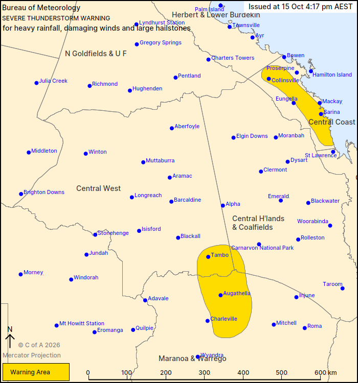
Severe thunderstorms are likely to produce heavy rainfall that may lead to flash flooding over the next several hours in parts of the Central Coast and Whitsundays district. Locations which may be affected include Collinsville and Sarina.
Severe thunderstorms are likely to produce damaging winds, large hailstones and heavy rainfall that may lead to flash flooding over the next several hours in parts of the Central Highlands and Coalfields, Central West and Maranoa and Warrego districts. Locations which may be affected include Tambo.
Severe thunderstorms are likely to produce damaging winds over the next several hours in parts of the North West district. Locations which may be affected include Mount Isa.
53 MM OF RAINFALL RECORDED AT ROCKY CREEK IN THE 30 MINUTES TO 5:34 PM
90 km/h wind gust was recorded at Mt Isa Airport at 5:08 pm